Transport

The EU-funded MAXIMA project is creating a low-cost and adaptable electric motor that promises enhanced performance, a smaller carbon footprint and reduced use of critical rare earth metals

If Europe’s automotive industry is to successfully transition to electric vehicles, it needs affordable components. These components also need to be energy efficient and recyclable, with minimal environmental impact. In addition, there is also the key challenge of minimising critical raw material use in these components to reduce current supply risks.

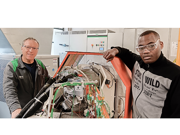
The MAXIMA(opens in new window) project was launched in 2023 to tackle these issues. MAXIMA (Modular AXIal flux Motor for Automotive) is addressing the need for scalable, sustainable electrification in the automotive industry by developing an affordable and adaptable axial flux motor. This motor is being designed to perform better, be kinder to the environment, and also reduce dependency on rare and critical raw materials, especially for permanent magnets.

On the digital front

“MAXIMA has established a pioneering multiphysics design and analysis platform that enables manufacturers and engineers to account for electromagnetic, structural and thermal performance, as well as recyclability, from day one,” reports Stéphane Clénet of project coordinator Arts et Métiers ParisTech. Making circularity a core constraint in the design process makes it possible to optimise efficiency, manufacturability, modularity and ease of disassembly.

Additionally, MAXIMA’s multiphysics digital twin allows for real-time system monitoring, predictive maintenance and adaptive control. Thanks to these capabilities, substantial advances in performance, reliability and system longevity can be achieved under real automotive operating conditions.

On the materials and manufacturing front

MAXIMA plans to deliver tested prototypes that combine soft magnetic composites and advanced electrical steels optimised to reduce losses and to facilitate manufacturability. “These process innovations are already lowering the CO₂ footprint and cost for new e-motor production,” comments Clénet.

Notable progress has further been made in end-of-life strategies for permanent magnets. MAXIMA researchers have successfully developed a recycling process in which neodymium-iron-boron magnets are recovered, purified and remanufactured for reuse. The process preserves most of their original properties despite contamination and wear. “This closes a crucial loop for high-value critical raw materials and points the way for sector-wide change,” observes Clénet.

Next on the agenda is to use the technology developed within the project until now in order to build and test multiple motor prototypes in realistic automotive environments. Recycling trials will be expanded, prototype production scaled up and life-cycle assessment models refined with real-world data.

By 2027, MAXIMA (Modular AXIal flux Motor for Automotive) intends to leave a tangible legacy that will play a role in accelerating the European automotive industry’s transition to circularity, strategic autonomy and climate neutrality. “In doing so, it will strengthen Europe’s global leadership in sustainable electrification technologies, creating long-term industrial, environmental and societal benefits,” Clénet concludes.

Digitally reconstructing and costing the Empire’s transport system across sea and land helps uncover how it influenced ancient urban development

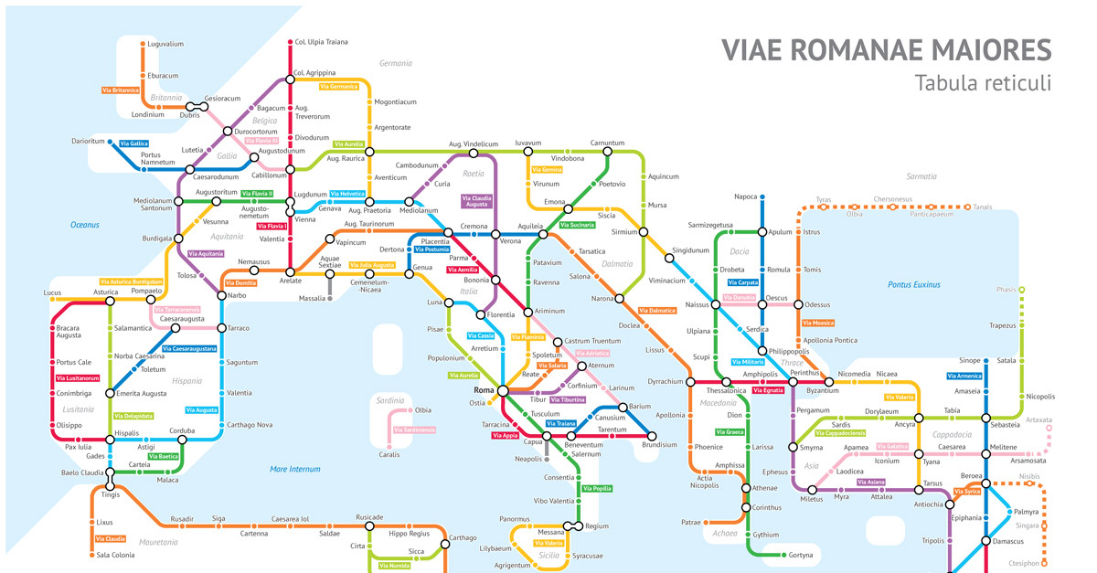
The Roman Empire was one of the largest empires of the ancient world. At its peak during the 2nd century CE, it spanned roughly 6 million square kilometres over Europe, Asia and Africa. Two of the most profound impacts on the physical world were the introduction of a widespread transport network and the large-scale development of cities it enabled. Yet, due to incomplete analysis and scant archaeological evidence of many routes, an understanding of this network’s influence through time has remained elusive. “We have a fairly good knowledge of the broad routes the roads took from some actual physical remains, as well as milestones or the occasional written itinerary,” explains Andrew Mclean, an archaeologist and researcher at the Barcelona Supercomputing Center (BSC) in Spain. “The main problem is that our knowledge is partial and lacks integration across the whole Empire,” he notes. In the EU-funded R3NUrb(opens in new window) project, Mclean and his colleagues at the BSC(opens in new window) turned to supercomputers to fill in this major knowledge gap and reconstruct and cost the entire Roman transport network. Using a combination of computation, remote sensing, network science and geostatistics, the team aimed to uncover the impact of large-scale transport connectivity on urban development in the Empire. “This project sought to automate the process of reconstructing a transport network, using only a few known sites – in this case some 40 urban centres on the edge of the Empire – to construct a fully costed network,” adds Mclean.

Constructing a cost network for transport connectivity

R3NUrb, supported by the Marie Skłodowska-Curie Actions(opens in new window) programme, followed computational approaches that used geospatial data to compute cost surfaces and probabilistic cost corridors and then construct a costed network. For land, the researchers fed in a range of factors including temperature, snow cover, altitude and details on the terrain type. 

Costing the sea followed a similar process but with factors such as seasonal wind patterns, current and wave height. This let the team create cost corridors and a network into which they could add new sites. For a case study on Roman urbanism, they used 1 500 urban centres.

Scaling up reconstructions

So far, the researchers have developed small-scale reconstructions of the entire network and are in the final stages of scaling it up to 100 m resolution. Already, the team has learned that using costs that reflect temporal changes can drastically change not only absolute costs but also relative costs in a model, something previously overlooked in archaeological mobility studies. The results also reinforce that Roman urban centres typically lie along natural movement corridors. “More importantly, for the first time, our results show that the corridors along which Roman urban centres lie are far less affected by seasonal conditions as compared to the wider landscape, and remain seasonally viable even when different routes may not be.”

A Google Maps for the Roman Empire

The team will soon publish the results of the terrestrial network and is simultaneously working on integrating the maritime network. One researcher is working on inland waterways, while a future collaboration with archaeobotanists at ICAC(opens in new window) will model archaeobotanical remains across the Empire. “Our ultimate aim is to develop an interactive, user-friendly, multimodal tool for modelling movement costs across the whole Empire – a ‘Google Maps’ for the Roman Empire,” says Mclean. “We hope, going forward, to demonstrate its utility for different periods and regions.”

It is a system, which combines IoT and AI, that can detect vehicles without the intention of stopping at junctions

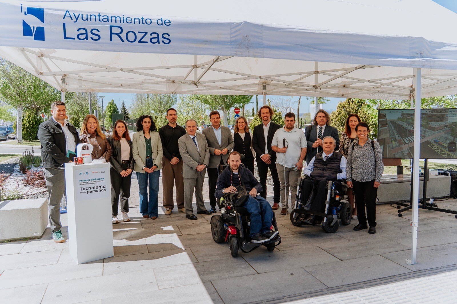
A unique innovation in Europe arrives in Las Rozas to protect pedestrians with disabilities. From today, the city of Las Rozas becomes the first municipality to test a pioneering technology on the street: a system that detects cars that do not brake at pedestrian crossings. It is a pilot project, WALKERPISA Project, which comes from the ONCE Foundation, together with Las Rozas Innova -Municipal Innovation Company of the City of Las Rozas-, and which aims to improve safety at pedestrian crossings for people with visual, hearing or intellectual disabilities. 

The technology of the "WALKERPISA Project" will be tested for two and a half months in a real urban environment and with real users after being validated in controlled environments. It is an innovative combination of cutting-edge technologies, such as the Internet of Things (IoT) and Artificial Intelligence (AI)– which are commonly used in aerospace, industrial or defence sectors – and is now being applied to urban accessibility.

"With this pilot, Las Rozas continues to position itself among the European cities that are committed to advanced technological solutions to build a more efficient, inclusive and safe urban model," says José de la Uz, mayor of Las Rozas and president of Las Rozas Innova.

Technology: IoT and AI for urban accessibility

The technology has been developed by SINGULAR THINGS and consists of a series of beacons equipped with sensors (LiDAR technology) that, placed next to pedestrian crossings, can detect vehicles without the intention of stopping, which, therefore, can constitute a danger for pedestrians with some type of disability. The beacons are capable of anticipating the risk and warning any pedestrian's mobile devices or smartwatch in advance through a mobile application (PISA app) that can be synchronised with a smartwatch and emit haptic (vibration), sound and visual signals.

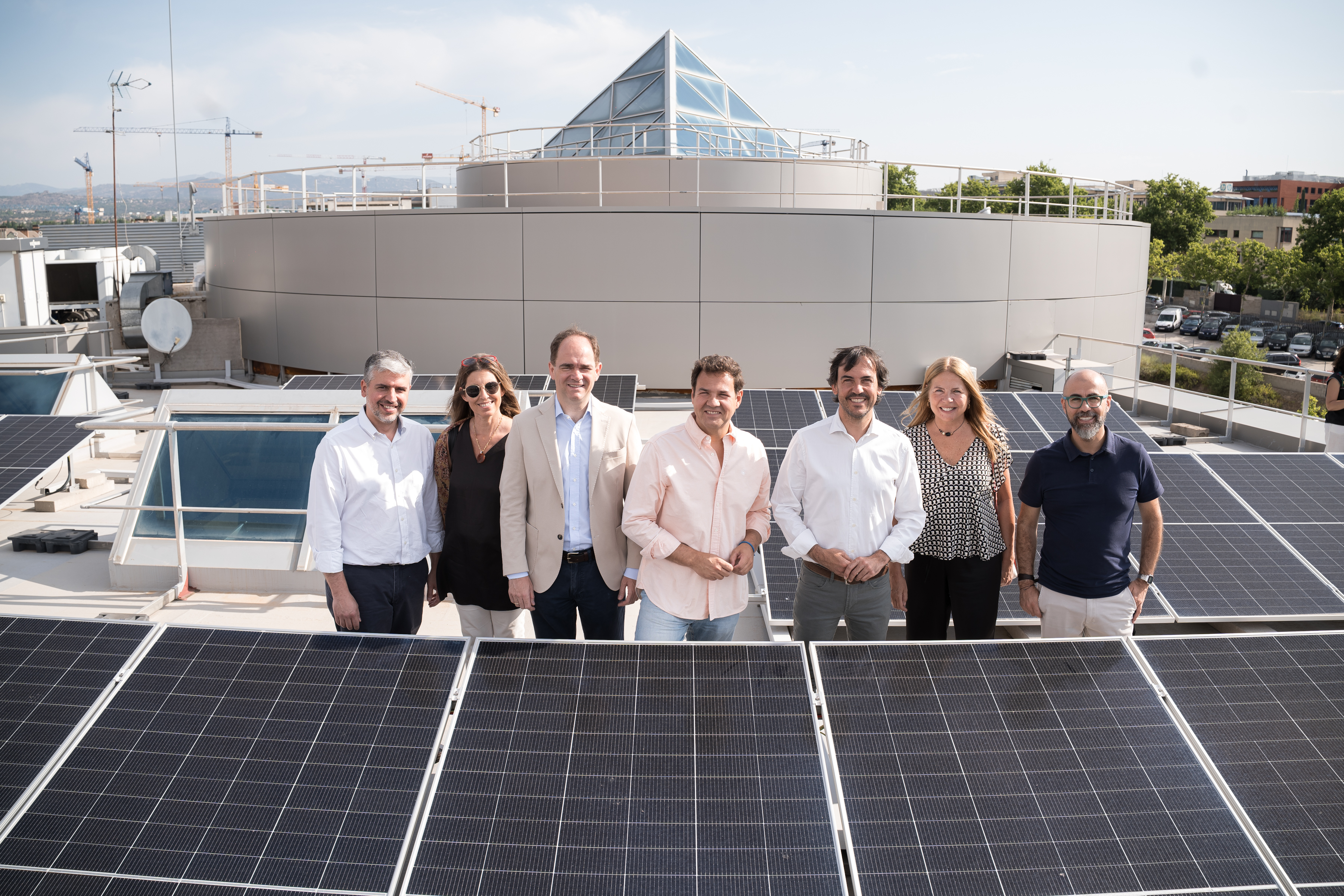
This morning, Jesús Hernández, the Director of Accessibility and Innovation of the ONCE Foundation,  visited together De la Uz the test environment in which the pilot project starts today: one of the pedestrian crossings with the most influx in the city, which is located on the boulevard of Camilo José Cela street, between Heron City and Las Rozas Village, where it will be evaluated how technology can reduce risks at crossings without traffic lights. The presentation was also attended by Almudena Alcaide, Director of R+D+i Fundación ONCE, and Javier Pascual, CEO of Singular Things.

Jesús Hernández, emphasised that "the implementation of projects such as Walkerpisa highlights the importance of collaboration between public and private entities to promote innovation with social impact. Initiatives developed by actors such as Las Rozas Innova show that, when administrations, technology companies and social organisations work in a coordinated way, it is possible to advance in solutions that improve safety, accessibility and, ultimately, the quality of life of people with disabilities, contributing to building more inclusive and intelligent urban environments".

"For Las Rozas it is a priority to continue advancing in technological solutions that improve the quality of life of all people. This pilot is especially relevant to us because Las Rozas is a city without traffic lights and where we are convinced that technology can increase safety and offer more autonomy to people with special needs or with some mobility, vision or hearing difficulty. Collaborating with the ONCE Foundation in a pioneering project such as WALKERPISA is a further step in our commitment to an innovative city and to technology as a tool for urban development, social inclusion and improvement of the lives of all residents", said José de la Uz.

A pilot to test the effectiveness and usability

These two and a half months of tests in Las Rozas will allow the technology to be evaluated in a real environment and its effectiveness in reducing risks at crossings without traffic lights, facilitating the safe transit of people with disabilities. The WALKERPISA Project will also enable technical, functional and user experience data to be collected in a dashboard with a digital twin that is capable of visualizing real time data: detected vehicles, environmental conditions and system operation.

During the trial period, people with blindness or low vision, deaf people and people with intellectual disabilities will participate as real users of the system.

Las Rozas, a testing space for innovative technology

Las Rozas Innova is the Municipal Innovation and Technological Development Company of the Las Rozas City Council, created in 2020, to promote the development of the city as a benchmark in the use of technology and innovation to improve citizen services and quality of life.

Thanks to Las Rozas Innova, Las Rozas has become an urban living lab for testing and validating innovative technology. Las Rozas, together with Las Rozas Innova, is already collaborating in 16 international R+D+i projects with a hundred cities, universities, companies and research institutes and organisations throughout Europe. The city has also become a platform for the promotion and acceleration of startups. The Las Rozas Innova Hub is the Innovation and Entrepreneurship Center of the Las Rozas City Council where more than 50 startups and companies are developing their technology with the possibility of testing their solutions innovative in real environments of the municipality and with real customers (neighbors, companies, schools, centers for the elderly).

A new study pieces together existing data sources in order to develop a detailed, dynamic picture of auto emissions

In a study focused on New York City, MIT researchers have shown that existing sensors and mobile data can be used to generate a near real-time, high-resolution picture of auto emissions, which could be used to develop local transportation and decarbonization policies.

The new method produces much more detailed data than some other common approaches, which use intermittent samples of vehicle emissions. The researchers say it is also more practical and scales up better than some studies that have aimed for very granular emissions data from a small number of automobiles at once. The work helps bridge the gap between less-detailed citywide emissions inventories and highly detailed analyses based on individual vehicles.

“Our model, by combining real-time traffic cameras with multiple data sources, allows extrapolating very detailed emission maps, down to a single road and hour of the day,” says Paolo Santi, a principal research scientist in the MIT Senseable City Lab and co-author of a new paper detailing the project’s results. “Such detailed information can prove very helpful to support decision-making and understand effects of traffic and mobility interventions.”

Carlo Ratti, director of the MIT Senseable City Lab, notes that the research “is part of our lab’s ongoing quest into hyperlocal measurements of air quality and other environmental factors. By integrating multiple streams of data, we can reach a level of precision that was unthinkable just a few years ago — giving policymakers powerful new tools to understand and protect human health.”

The new method also protects privacy, since it uses computer vision techniques to recognize types of vehicles, but without compiling license plate numbers. The study leverages technologies, including those already installed at intersections, to yield richer data about vehicle movement and pollution.

“The very basic idea is just to estimate traffic emissions using existing data sources in a cost-effective way,” says Songhua Hu, a former postdoc in the Senseable City Lab, and now an assistant professor at City University of Hong Kong.

The paper, “Ubiquitous Data-driven Framework for Traffic Emission Estimation and Policy Evaluation,” is published in Nature Sustainability.

The authors are Hu; Santi; Tom Benson, a researcher in the Senseable City Lab; Xuesong Zhou, a professor of transportation engineering at Arizona State University; An Wang, an assistant professor at Hong Kong Polytechnic University; Ashutosh Kumar, a visiting doctoral student at the Senseable City Lab; and Ratti. The MIT Senseable City Lab is part of MIT’s Department of Urban Studies and Planning.

Manhattan measurements

To conduct the study, the researchers used images from 331 cameras already in use in Manhattan intersections, along with anonymized location records from over 1.75 million mobile phones. Applying vehicle-recognition programs and defining 12 broad categories of automobiles, the scholars found they could correctly place 93 percent of vehicles in the right category. The imaging also yielded important information about the specific ways traffic signals affect traffic flow. That matters because traffic signals are a major reason for stop-and-go driving patterns, which strongly affect urban emissions but are often omitted in conventional inventories.

The mobile phone data then provided rich information about the overall patterns of traffic and movement of individual vehicles throughout the city. The scholars combined the camera and phone data with known information about emissions rates to arrive at their own emissions estimates for New York City.

“We just need to input all emission-related information based on existing urban data sources, and we can estimate the traffic emissions,” Hu says.

Moreover, the researchers evaluated the changes in emissions that might occur in different scenarios when traffic patterns, or vehicle types, also change.

For one, they modeled what would happen to emissions if a certain percentage of travel demand shifted from private vehicles to buses. In another scenario, they looked at what would happen if morning and evening rush hour times were spread out a bit longer, leaving fewer vehicles on the road at once. They also modeled the effects of replacing fine-grained emissions inputs with citywide averages — finding that the rougher emissions estimates could vary widely, from −49 percent to 25 percent of the more fine-tuned results. That underscores how seemingly small simplifications can introduce large errors into emission estimates.

Major emissions drop

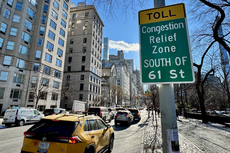
On one level, this work involved altering inputs into the model and seeing what emerged. But one scenario the researchers studied is based on a real-world change: In January 2025, New York City implemented congestion pricing south of 60th Street in Manhattan.

To study that, the researchers looked at what happened to vehicle traffic at intervals of two, four, six, and eight weeks after the program began. Overall, congestion pricing lowered traffic volume by about 10 percent — but there was a corresponding drop in emissions of 16-22 percent.

This finding aligns with a previous study by researchers at Cornell University, which reported a 22 percent reduction in particulate matter (PM2.5) levels within the pricing zone. The MIT team also found that these reductions were not evenly distributed across the network, with larger declines on some major streets and more mixed effects outside the pricing zone.

“We see these kinds of huge changes after the congestion pricing began, Hu says. “I think that’s a demonstration that our model can be very helpful if a government really wants to know if a new policy converts into real-world impact.”

There are additional forms of data that could be fed into the researchers’ new method. For instance, in related work in Amsterdam, the team leveraged dashboard cams from vehicles to yield rich information about vehicle movement.

“With our model we can make any camera used in cities, from the hundreds of traffic cameras to the thousands of dash cams, a powerful device to estimate traffic emissions in real-time,” says Fábio Duarte, the associate director of research and design at the MIT Senseable City Lab, who has worked on multiple related studies.

The research was supported by the city of Amsterdam, the AMS Institute, and the Abu Dhabi’s Department of Municipalities and Transport.

It was also supported by the MIT Senseable City Consortium, which consists of Atlas University, the city of Laval, the city of Rio de Janeiro, Consiglio per la Ricerca in Agricoltura e l’Analisi dell’Economia Agraria, the Dubai Future Foundation, FAE Technology, KAIST Center for Advanced Urban Systems, Sondotecnica, Toyota, and Volkswagen Group America.Text: Peter Dizikes | MIT News

MarLEN announces first transnational call for research and innovation projects promoting pollution-free transport in Europe’s waters

The EU-funded MarLEN(opens in new window) project recently issued its first transnational call(opens in new window) for projects supporting the decarbonisation of maritime and inland waterway transport. The call offers researchers and innovators the opportunity to secure funding that will help propel their work from early-stage research and development to market deployment.

Launched at the start of 2025, MarLEN has brought together 13 ministries and funding organisations from nine European countries to support research and innovation in waterborne technologies with zero emissions as the goal. The project is working to strengthen European research in this field by coordinating and developing synergies between national and regional maritime and inland waterway research programmes and policies in line with the aims of the EU’s Zero Emission Waterborne Transport partnership(opens in new window) (ZEWT).

Who can apply

The call is part of MarLEN’s efforts to promote knowledge exchange and collaboration across countries and support joint actions spanning the entire innovation chain, from research to market. A related news item(opens in new window) notes the call is open to applicants from the nine MarLEN participating countries: Belgium, Germany, Ireland, Italy, Norway, Portugal, Romania, Turkey and the United Kingdom. Applicants from countries that are not partners in the MarLEN consortium are welcome to participate in the call, provided they can secure national funding and consortium approval.

Projects must involve at least two independent legal entities from at least two different countries, with industry participation required. SME involvement is strongly encouraged. Consortia should include ports and shipping operators on relevant routes on which the proposed solutions can be implemented.

What topics are funded

The projects’ research and development should be original and innovative, and it must align with ZEWT objectives, focusing on fuels and technologies that will enable the early adoption of promising long-term solutions for today’s polluting waterborne transport sector. Projects should cover technological innovations in the following fields: sustainable alternative fuels; electrification; energy efficiency, design and retrofitting; digital green tech; and ports and related infrastructure. The first call focuses on three main priority areas, namely early concepts and industrial research, experimental development and innovation, and end-user involvement and demonstration.

Maximum project duration is up to 36 months, and funding is dependent on national rules and availability. The project’s call announcement, specific application rules for Turkish applicants, and national guidelines and regulations for Norwegian applicants can be all be accessed through this link(opens in new window). Consortia interested in participating in the call must apply by 30 September 2025.

The first MarLEN call will help to deepen, broaden and strengthen existing transnational cooperation, consolidating it in a way that it becomes self-sustaining. It will also boost transnational research covering the entire innovation chain, identifying and responding to current research gaps. Ultimately, it will enhance the competitiveness of the European research community in the field of maritime technologies and play a role in ushering the European maritime industry into a zero-emission future. The MarLEN (Maritime Low Emission Network) project ends in 2029.

Featured

Most Read

We use cookies

We use cookies on our website. Some of them are essential for the operation of the site, while others help us to improve this site and the user experience (tracking cookies). You can decide for yourself whether you want to allow cookies or not. Please note that if you reject them, you may not be able to use all the functionalities of the site.